Finding the right map resources helps students explore geography with confidence. This guide reviews five student-focused world maps and US maps that blend durability, clarity, and engaging design. Each option supports classroom, homeschooling, and dorm study spaces with clear labeling and durable construction.
Summary of selected products:
| Product | Format | Use Case | Key Benefit |
|---|---|---|---|
| Lighthouse Geographics US & World Desk Map | Desk map (13″ x 18″), laminated | Classroom or home study | Two-sided US and world maps in a compact, laminated format |
| Palace Learning Laminated World & US Map Poster Set | Posters (18″ x 29″) | Wall display, group learning | Durable lamination with separate US and world views |
| JAWO World Map Tapestry | Wall tapestry (60″ x 40″) | Large visual centerpiece | Vibrant, durable tapestry for immersive geography |
| Maps International Scratch The World Map | Framed scratch-off wall map | Interactive learning | Scratch-off destinations reveal color for engagement |
| Swiftmaps 24×36 World Map Poster | Poster (24″ x 36″), laminated | Dry-erase classroom poster | 3D relief and durable lamination for frequent use |
Lighthouse Geographics US & World Desk Map
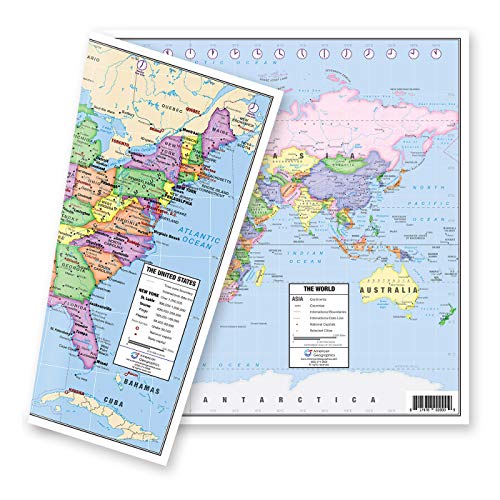
The Lighthouse Geographics desk map is a two-sided, laminated teaching tool. One side presents a political map of the United States with clear delineation of the 50 states, Hawaii and Alaska inserts, major cities, time zones, and red-star state capitals. The flip side reveals a detailed world map with current geographic information, plus a zoomed Europe insert for focused study. Its compact 13″ x 18″ size makes it ideal for student desks and small study spaces, enabling quick reference during lessons and independent research.
Palace Learning Laminated World Map & US Map Poster Set

This 2-piece poster set includes a world map and a United States map, both laminated for durability. Measuring 18″ x 29″ each, these posters provide a bright, accessible reference for classrooms or home study zones. The material and finish are designed to withstand frequent handling, erasing, and re-use, making them suitable for ongoing geography lessons, group activities, and independent learning projects.
JAWO World Map Tapestry

The JAWO World Map Tapestry is a large tapestry made from premium polyester. It serves as a vivid focal point for any learning space, showcasing a colorful world with countries and major cities. Its size (60″ x 40″) creates an immersive backdrop for geography lessons, student projects, and wall displays that encourage exploration of continents, oceans, and cultural diversity.
Scratch The World Map
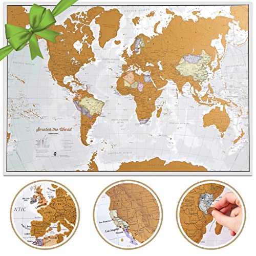
The Scratch The World Map by Maps International offers an interactive learning experience. This large, scratch-off map allows students to mark visited destinations by revealing a vibrant color layer underneath. It emphasizes geographic literacy, travel planning, and cultural awareness, with detailed country borders and topographic cues. The updated 2025 edition provides current boundaries and place names, supporting engaging classroom activities and independent exploration.
Swiftmaps 24×36 World Map Poster

The Swiftmaps 24×36 World Map Poster is a large laminated wall map designed for classrooms and study spaces. It features durable 3-mil lamination and a dry-erase surface, making it easy to annotate locations, plan routes, or track changes. The rolled, not folded, format helps maintain a flat, accurate display, while its 3D relief shading aids in visualizing terrain and ocean depth for a more engaging geography lesson.
Buying Guide: Key Purchase Considerations
When choosing maps for students, consider size, durability, and learning style. Desk maps are ideal for individual study, while posters and tapestries support classroom-wide displays. Laminated surfaces resist wear and allow dry-erase use, increasing longevity between lessons. Interactive options, such as scratch-off maps, can heighten engagement by turning geography into a hands-on activity. Color clarity, labeling, and the inclusion of political boundaries or physical features impact readability for different ages. Finally, assess ease of mounting and space requirements to ensure the map complements both walls and desks in your learning environment.
Durability and format vary by product. Desk maps balance portability with legibility, making them suitable for student desks and tutoring spaces. Laminated posters provide vibrant, long-lasting visuals, great for group instruction and wall displays. Tapestries offer expansive visual impact but require wall space. Interactive options like scratch-off maps motivate exploration by rewarding progress. For younger learners or classroom decor, bright, clearly labeled maps with simple legends improve comprehension and retention. Finally, consider whether a map’s scale or zoomed-in regions align with your curriculum goals, whether global studies, regional geography, or US-centric lessons.